
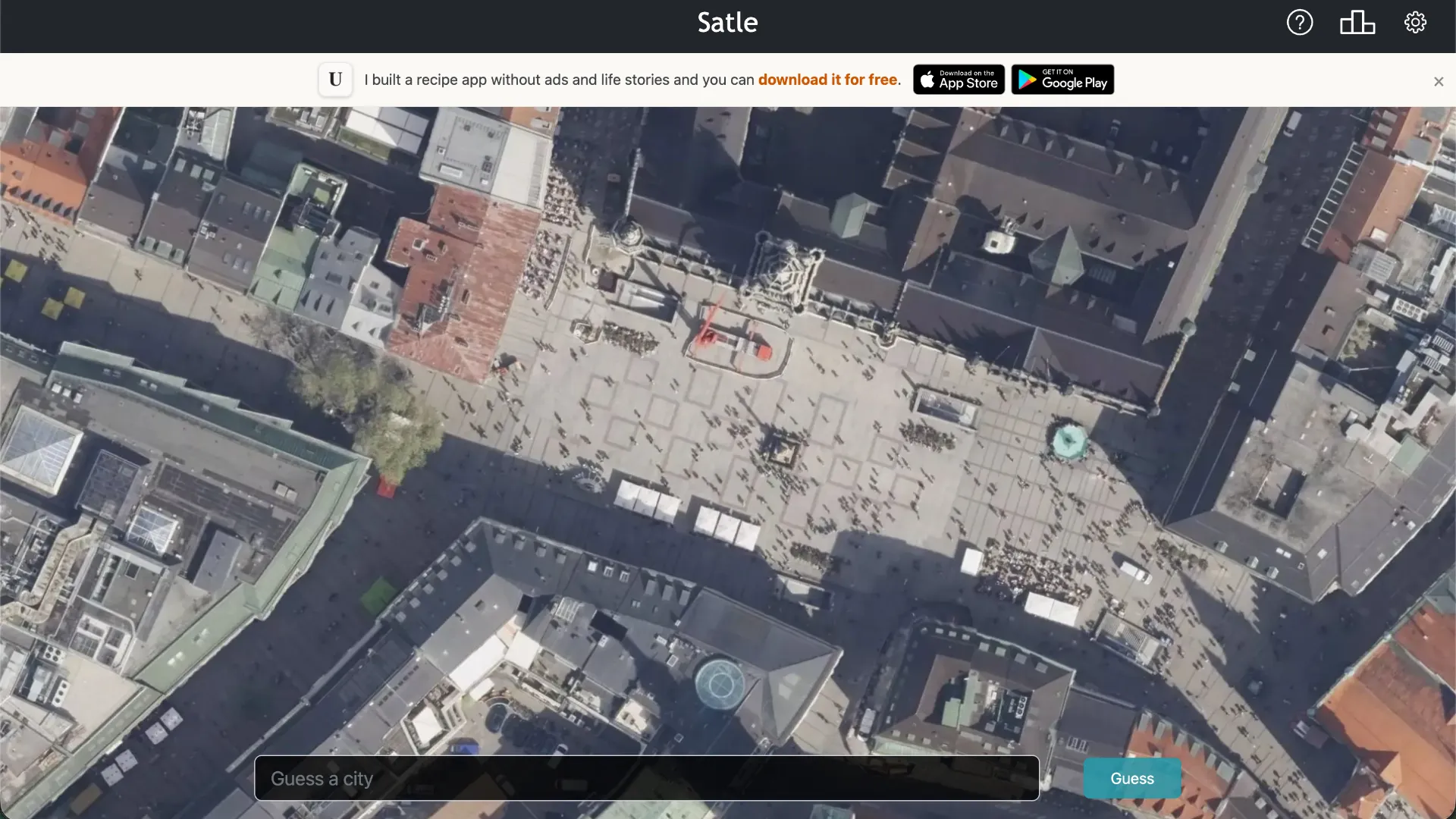
What Is Satle?
Satle is a daily geography guessing game built around satellite images of cities around the world. You begin with a tightly cropped overhead image and have six guesses to identify the correct city.
The main twist is progressive zoom. Every incorrect guess causes the satellite image to zoom farther out, revealing more roads, neighborhoods, coastlines, rivers, terrain, and other geographic context. Satle also tells you the direction and distance from your incorrect guess to the target city.
A new Satle is released each day, so everyone can work on the same daily location.
The Core Satle Rules
Each puzzle begins with a satellite image centered on an unknown city.
You search for a city, select the matching city and country from the autofill list, and submit it as your guess.
If your answer is incorrect, Satle provides two important pieces of new information:
- The satellite image zooms out, showing a larger surrounding area.
- You receive the direction and distance from your guessed city to the correct city.
You can make up to six guesses before the round ends.
Previous guesses can also be selected again to revisit earlier satellite images, which is useful when comparing details visible at different zoom levels.
How to Play Satle
- Study the opening satellite image. Look for coastlines, rivers, street patterns, airports, harbors, mountains, parks, bridges, or distinctive urban layouts.
- Enter a city guess. Type a city name and select the correct city-country combination from the autofill suggestions.
- Read the feedback after a miss. Note both the distance and compass direction from your guess to the target.
- Inspect the wider satellite view. Each incorrect answer reveals more of the surrounding region, giving you additional geographic clues.
- Refine your guesses. Combine visual evidence with the distance and direction information until you identify the city within six attempts.
Example of the Satle Mechanic
Imagine the first image shows a dense coastal city with a large harbor, but there is not enough context to identify it confidently.
You guess:
Barcelona, Spain
Satle tells you that the target is thousands of kilometers to the southeast and then zooms the image out.
The expanded view now reveals a different coastline shape, dry terrain, and a major urban area beside a bay.
Instead of choosing another random coastal city, you can use both types of evidence:
Satellite features + Direction + Distance
Your next guess should therefore be a city located roughly the indicated distance and direction from Barcelona while also matching the newly visible landscape.
This feedback loop is the heart of Satle.
What to Look for in the Satellite Image
Satellite imagery contains more clues than it may appear to at first.
Coastlines
A distinctive bay, peninsula, island, or waterfront can immediately narrow the possibilities. Coastal orientation can also help determine which side of a continent or country you are viewing.
Rivers
Large rivers passing through city centers are particularly useful. Look at the river's width, number of bends, islands, and bridges.
Street Patterns
Cities can have very different layouts. Some use rigid grids, while others have radial avenues, winding historic streets, large planned blocks, or highways cutting through the center.
Terrain
Mountains, deserts, forests, flat plains, and surrounding agricultural land can help identify both the region and climate.
Airports and Ports
Large runways, container terminals, docks, and artificial harbor structures can be extremely recognizable from above.
Urban Density
The shape and density of development can help distinguish compact historic cities from sprawling metropolitan areas.
Satle Strategy Tips
- Do not waste the first guess. Even if you cannot identify the exact city, choose a reasonable location that can give you useful distance and direction information.
- Use distance geometrically. If a guess is 2,000 km northwest of the answer, mentally shift your search area approximately that far southeast rather than guessing another nearby city.
- Combine clues instead of chasing one feature. A coastline alone may match many cities, but coastline shape plus climate plus distance can narrow the possibilities dramatically.
- Pay attention to water orientation. Knowing whether the sea lies north, south, east, or west of the city can quickly eliminate candidates.
- Use later zoom levels differently. Early images are useful for landmarks and street patterns; later images reveal regional geography and city shape.
- Revisit previous images. Satle lets you click earlier guesses to compare older zoom levels, which can reveal details you overlooked initially.
- Think globally. The answer can come from cities around the world, so avoid assuming every familiar-looking urban layout belongs to North America or Europe.
Distance and Direction Clues
Satle's distance feedback is one of its strongest deduction tools.
Suppose your first guess is Tokyo and the target is shown as approximately 1,100 km southwest. Your next search should focus on cities in that general zone rather than other East Asian cities chosen only because they visually resemble the image.
After another guess, you effectively create a second geographic constraint. Combining two distance-and-direction clues can shrink the possible area dramatically.
The settings also allow players to choose their preferred distance units, including kilometers or miles, and distance display can be adjusted if you prefer a more visually focused challenge.
How Satle Differs From Other Geography Games
Satle does not begin with a country silhouette or a Street View panorama. Its clues come from overhead satellite imagery.
That changes what matters. Instead of reading road signs or recognizing languages, you examine city structure, geography, waterways, terrain, and regional scale.
The progressive zoom mechanic also means the puzzle becomes more informative after each miss. Early guesses test visual recognition, while later guesses increasingly reward geographic deduction.
Daily Play and Statistics
Satle releases a new puzzle every day and tracks player statistics such as games played, win percentage, current streak, longest streak, and guess distribution.
The game also provides a share-results option, making it easy to compare how many attempts you needed without revealing the answer directly.
Satle can be played in a web browser, and mobile versions are also available for iOS and Android.
Who Should Play Satle?
Satle is a strong choice for players who enjoy geography, maps, satellite imagery, city identification, and deduction puzzles. It works especially well for players who like GeoGuessr-style geographic reasoning but want a shorter daily challenge with structured feedback.
You do not need to recognize the city immediately. The expanding satellite view plus distance and direction clues give you a logical path toward the answer even when the opening image looks completely unfamiliar.