SatPin

SatPin
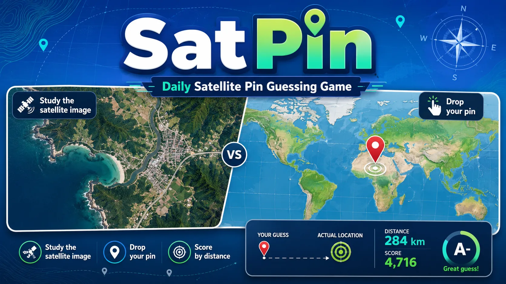
SatPin is a daily satellite geography game where you study a satellite image and drop a pin on the world map. Your score depends on how close your guess is to the real location.
What is SatPin?
SatPin is a daily satellite geography game where you look at a real-world satellite image and try to pinpoint where it is on the map. Instead of typing a city or country name, you place a pin as close as possible to the correct location.
It is fun because it turns geography into a visual deduction challenge. Rivers, coastlines, roads, city grids, mountains, deserts, ports, dams, and islands all become clues that help you make a smarter map guess.
SatPin Game Rules
- Each challenge shows a satellite image of a real location.
- You study the image and look for geographic clues.
- Click or tap the world map to place your guess pin.
- The closer your pin is to the real location, the higher your score.
- After guessing, the game shows distance-based feedback.
- Daily challenges give you a fresh location puzzle to solve.
- Themed categories may include volcanoes, artificial islands, mega dams, planned cities, river deltas, atolls, airports, ports, canals, and other satellite-visible features.
- The goal is to score as accurately as possible by reading the landscape from above.
How To Play SatPin?
-
Player Action: Study the satellite image carefully.
Game Response: SatPin shows a top-down view of a landscape, city, coastline, or man-made feature.
What You Learn: Shapes, colors, terrain, roads, water, and built structures can point to a region or feature type. -
Player Action: Identify the strongest visual clues.
Game Response: The image remains available while you reason through the location.
What You Learn: Deltas, volcanoes, islands, ports, runways, reservoirs, and city layouts can narrow the search area. -
Player Action: Click on the map where you think the location is.
Game Response: The game records your pin placement as your guess.
What You Learn: Your accuracy depends on both broad geography knowledge and precise map placement. -
Player Action: Review the result after submitting.
Game Response: SatPin shows how far your guess was from the actual location.
What You Learn: Distance feedback helps you understand whether your visual deduction was close or far off. -
Player Action: Use what you learned for the next challenge.
Game Response: Your score reflects how accurately you pinned the location.
What You Learn: Repeated play builds satellite-image intuition and geography memory.
Strategy & Tips
- Start by deciding whether the image is mostly natural, urban, coastal, desert, mountainous, or agricultural.
- Use water shapes carefully: river deltas, atolls, canals, reservoirs, and coastlines can be very distinctive.
- Look for human-made geometry such as runways, ports, dams, bridges, planned grids, and artificial islands.
- Climate clues matter: vegetation color, desert tones, snow, and coastline style can suggest a region.
- For cities, compare road patterns, density, and layout before placing your pin.
- If the image shows a famous landform or structure, zoom the map mentally from broad region to exact spot.
- Do not rush the pin placement; small map differences can strongly affect your distance score.
SatPin FAQ
Is SatPin free to play?
SatPin is available as a web-based satellite geography game. Check the official SatPixel page for the current play options.
What kind of game is SatPin?
SatPin is a geography guessing game where players identify real-world locations from satellite imagery and place a pin on the map.
How do you play SatPin?
You study a satellite image, choose the likely location on the world map, place a pin, and receive a score based on distance from the correct answer.
Is SatPin like Wordle?
SatPin is Wordle-like because it has daily puzzle appeal, but the gameplay is closer to GeoGuessr-style map guessing with satellite images and distance scoring.
Is SatPin good for beginners?
Yes. Beginners can enjoy the visual clues and improve over time, while geography fans can chase more precise pins and higher scores.
Final Take
SatPin is a great choice for players who enjoy geography, satellite imagery, map puzzles, and visual deduction. Try it if you want a daily challenge that rewards careful observation and real-world location knowledge.